
 DE
 EN
What must a site plan contain? The German state rules
Scale, contents, official site plans: what the building submission ordinances require, using North Rhine-Westphalia, Bavaria and Brandenburg as examples.
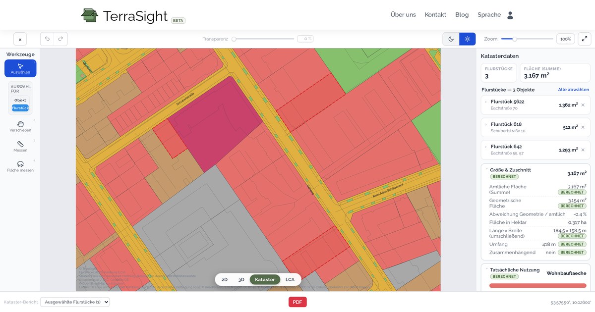
Screenshot of the TerraSight editor, Hamburg. Parcels: © Freie und Hansestadt Hamburg, LGV (2026), dl-de/by-2-0; Streets: Freie und Hansestadt Hamburg, Behörde für Verkehr und Mobilitätswende; Map: © GeoBasis-DE / BKG (2026) CC BY 4.0; © OpenStreetMap contributors. Data edited for display.
The site plan is part of the documents for a building application. There is no single nationwide list of what it must contain: building regulations are a matter for the federal states, and each state sets out in its own ordinance what the plan must show and who prepares it. This article compares three states using the text of their ordinances, checked in November 2026.
This overview is not legal advice and covers only North Rhine-Westphalia, Bavaria and Brandenburg. What counts is the current text of your state's ordinance and the answer from your local building authority.
Scale and basis compared
The rules already differ on scale. A plan that is sufficient in one state may be too coarse in another.
| State | Ordinance | Scale | Basis |
|---|---|---|---|
| North Rhine-Westphalia | BauPrüfVO, §§ 2, 3 | at least 1:500, larger if needed for the assessment | Extract from the cadastre: cadastral map within a 50 m radius, officially certified and no older than six months |
| Bavaria | BauVorlV, § 7 | at least 1:1000, larger if needed for the assessment | Extract from the cadastre showing the plot and neighbouring plots within at least 50 m; certified or retrieved through an approved automated procedure |
| Brandenburg | BbgBauVorlV, §§ 1, 3, 4 | 1:100, or 1:200 if that is sufficient for the required information | Cadastre; project-specific site plan based on the official site plan, where one is required |
What belongs on the plan in all three states
The lists are structured differently, but the core is the same. Where needed to assess the project, all three ordinances require:
- Orientation: the direction of north.
- Plot: parcel numbers, boundaries and designation of the building plot and neighbouring plots, plus owner details.
- Elevations: the elevation of the plot's points.
- Existing buildings: structures on the plot and relevant neighbouring buildings, with details such as heights.
- Access: adjoining public roads with width and elevation.
- Planning law: provisions of the development plan or other statutes affecting the project.
- Project: the planned structures with external dimensions, distances to boundaries and buildings, and setback areas.
- Open space: the layout of unbuilt areas with access, parking, play areas and fire brigade areas.
- Special features: listed monuments, hydrants or other firefighting water points.
Trees are a good example of the differences in detail: North Rhine-Westphalia and Bavaria explicitly name protected trees, while Brandenburg lists protected landscape features and forest.
Simple and official site plans
Not every site plan may come from the design office itself. In North Rhine-Westphalia it must be prepared and certified by a cadastral office or a publicly appointed surveyor if this is requested or in certain cases, such as boundaries that have not been formally established, structures crossing a boundary, or public-law easements (Baulasten). That is the official site plan.
Brandenburg separates two documents: the official site plan from a cadastral authority or publicly appointed surveyor, where required, and the project-specific site plan showing the planned project. So names and responsibilities vary between states. Find out early which form your project needs, because commissioning a survey takes time.
Different standards apply in studies and competitions
The ordinances govern building applications. They say nothing about student design projects, acquisition or early design. There, what counts is whether the plan makes the place clear and suits the project. In competitions, the brief sets scale and presentation.
What TerraSight is and is not for
TerraSight does not produce an official site plan or a certified cadastral extract. It is a tool for the base drawing and its presentation: it combines official geodata into an editable plan with parcels and parcel numbers, buildings, streets, trees, north arrow and scale. The cadastre view adds up selected parcels and shows actual land use from ALKIS. The DXF export carries the plan on into CAD.
For a building application, this still leaves elevations, owner details, Baulasten, utility lines, development plan provisions and the setback calculation, among others. This information has to come from the responsible authorities and your own planning.
Sources
- North Rhine-Westphalia: BauPrüfVO, valid from 26 Nov 2024, §§ 2 and 3 (in German)
- Bavaria: BauVorlV, § 7, version from 1 Jan 2025 (in German)
- Brandenburg: BbgBauVorlV of 28 July 2009, §§ 1, 3, 4 and 11 (in German)
Last updated: