

 DE
 EN
AI in architecture school: site plans without the routine work
Where the hours on a site plan go, what can be automated, what AI really contributes and what TerraSight can do today.
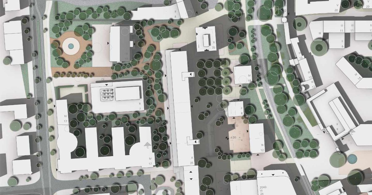
Almost every design project in architecture school starts with the site plan: only once the plot, neighbouring buildings, streets and trees are on the sheet can the project be discussed. In a survey of architecture students at BTU Cottbus-Senftenberg, one site plan took about eight hours on average. This article looks at where that time goes, how much of it is routine, and what AI actually changes.
Where the hours go
Germany has most of the data a site plan needs, just not in one place. Cadastre, maps and aerial photos sit with the surveying authorities of the 16 federal states, each with its own geoportal. So the work usually goes like this:
- Finding data: locating the right state portal, picking the area, downloading map and parcels.
- Combining: layering and aligning map, parcels and aerial photo in CAD or a graphics program.
- Tracing: trees and other existing features are often missing or outdated in official data, so they get traced from the aerial photo.
- Styling: colours, textures, line weights and shadows. A site plan is also a presentation graphic. In the survey, textures and colours were named most often as the most time-consuming step.
Only the last point has anything to do with design, and even there much is repeated: the same settings for every new plan.
What is automation and what is AI
Everything in this field quickly gets called “AI”. But these are two different things, and the difference matters for how far a plan can be trusted.
Fetching data needs no AI. Official data is recorded and available through standardised services. Software can fetch it for an area and assemble it into layers. The result is repeatable and has a traceable source. Our overview of official geodata explains which services these are.
AI fills the gaps. Where data is missing, image recognition helps: a model detects trees in the aerial photo and proposes them as objects. That remains an estimate. Crowns overlap, shadows mislead, and not every detected tree is still standing. So every AI result needs a review step.
The 2025 professional survey by the German Federal Chamber of Architects (15,624 members, in German) fits this split: 29 percent use AI-based tools in their daily work, and 72 percent of those use them for routine planning tasks. As mandatory or very important conditions they name reliable data quality (86 percent), traceable results (82 percent) and keeping control over planning decisions (71 percent). All respondents see the uncritical adoption of data as the biggest risk (71 percent).
How this works in TerraSight
TerraSight is a site plan editor that runs in the browser, with no installation and no GIS knowledge needed. The process has five steps:
- Pick the area: search for a place and set the map view.
- Process: TerraSight loads basemap.de, ALKIS parcels, municipal street and tree data where available and the state aerial photo, and builds a layered plan from them.
- Review and add: a transparency slider lays the plan over the aerial photo. The Tree AI runs locally in your browser and proposes trees that you keep or discard.
- Style: with presets, one click recolours the whole plan, and your own style can be saved for the next one. There is also a 3D view.
- Export: PDF for print, SVG for graphics software, DXF for CAD.
What stays manual
The plan is a starting point. Which trees stay, how the project sits in its neighbourhood and what graphic attitude the plan takes are your decisions. That is what the time should be freed up for.
What to check on an automatically generated site plan
- Compare with the aerial photo: new buildings, demolitions and felled trees often show up in the data later.
- Know the data date: cadastre, map and aerial photo differ in how current and how accurate they are.
- Keep the attribution: some data licences require it. TerraSight adds it on export, and it must not be removed.
- Be clear about the purpose: the plan is a good basis for design and presentation. Building applications follow their own rules in each federal state.
Where TerraSight stands today
TerraSight is online as an open beta and free to use. Besides the editor there are team features and cloud projects, a cadastre view for selecting parcels with area totals, land-use shares and a PDF report, and an LCA view that derives first environmental metrics from the plan geometry and outputs a PDF report. All features are on the product page.
Where the product is heading
- Better detection: the Tree AI keeps being trained on the official aerial photos of the federal states.
- More life-cycle assessment: today the LCA view gives a pre-study based on benchmarks. It is meant to grow step by step into an early-design LCA using material data from ÖKOBAUDAT.
- BIM connection: alongside DXF, an IFC export is in development.
What comes next also depends on your feedback. Try it on your next site and tell us what is missing.
Last updated: